
|
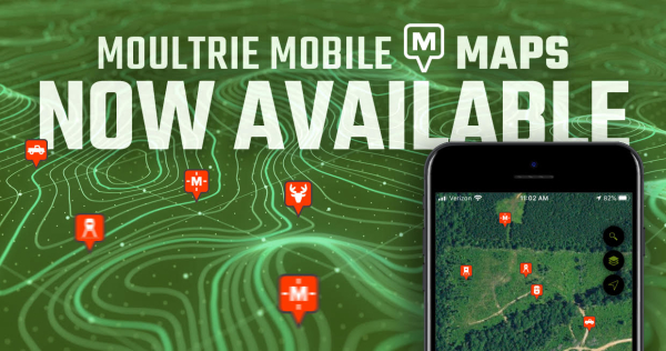
Moultrie Mobile is proud to announce that its newest feature, Interactive Maps, is now live! Members can begin using this FREE feature now by updating their Moultrie Mobile app in the App Store or Google Play Store.
With Interactive Maps, members can quickly place pins and build a visual layout of deer activity, camera and stand locations, and much more. This new feature is an important addition to the toolset provided by Moultrie Mobile for hunt planning and land management.
Start using Interactive Maps by clicking the Maps icon inside the app.
Like all Moultrie Mobile features, Interactive Maps is free to all members. No extra fees or additional plans are needed to start enjoying Maps today.
Want to learn more? Download the app and demo Moultrie Mobile today for free.